Saturday, December 5, 2020

Final Hazards Report

 U.S. Relations With the Republic of Korea - United States Department of  State

South Korea's Main Hazards

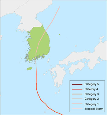
The two main hazards that are most dangerous are Typhoons and Flooding. Typhoons have affected South Korea the most by bringing dangerous wind speeds and major flooding, it may not have been a very strong typhoon, but it causes major damage to just about everything. These occur due to many traces of warm water that can turn into an intense storm. 

These are the priority hazards because they lead to mass wasting, landslides, tsunamis, and more. They destroy hundreds to thousands of homes, many people suffer injuries or death, and damage to the buildings and structures are extremely hard to repair, especially when mass wasting occurs. These are also a priority because they occur a lot throughout this area such as the Korean Peninsula, Japan, Southern China, etc. 

The recommendations I have are to rebuild homes and structures with concrete, so neither winds nor flooding would cause significant damage. I would move buildings away from high-risk areas and make them the average height of a company building to avoid the damage of a tall building, risking even more lives. I would also make sure to cover everything if damage does occur after rebuilding. As there are many known rivers in South Korea, the most known being the Han River can make flooding more dangerous as these waters will rise dangerously high. I would invest in water systems such as dams to prevent future major flooding. These measures would be the best to protect the country and prevent typhoons and flooding.

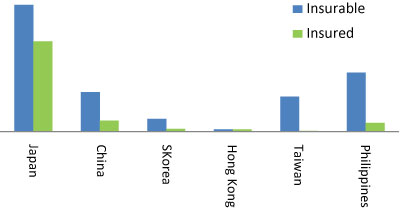
.Cat Bond Figure 1 Event 1

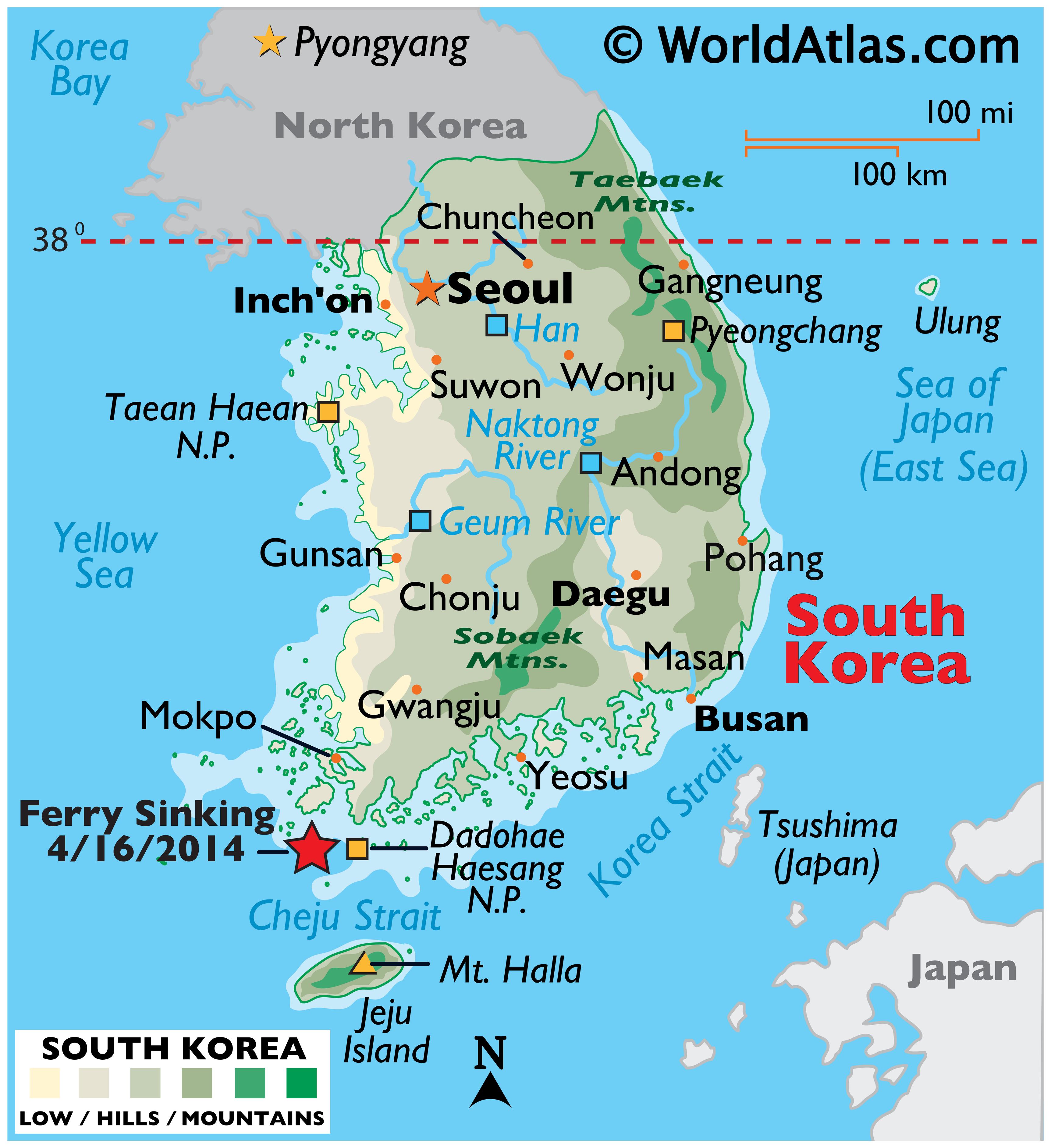
The areas that would need the most help would the the country's capital, Seoul, as it is a big city surrounded with many tall buildings and busy roads. Next would be around Busan since it is similar to Seoul and is close to the border which would affect it the most if flooding were to occur. Then around Pyeongchang, it is also close to the border and is most popular for it's docks and business area.

Cat Bond Figure 1 Event 1

The spot I would construct my house would be around either Chonju or Andong areas. They are both more inland compared to Inchon or Busan. They also are surrounded by hill or mountains compared to low ground. If my home were to be made of concrete to hold back strong winds and prevent damage from flooding, it would be a great spot. 

South Korea Maps & Facts - World Atlas

Works Cited:

“Wow, South Korea Just Experienced Three Typhoons in a Row.” AIRWorldwide, 10 Sept. 2020, www.air-worldwide.com/blog/posts/2020/9/wow-south-korea-just-experienced-three-typhoons-in-a-row/.

“Managing Typhoon Risk in South Korea.” AIRWorldwide, 14 Dec. 2010, www.air-worldwide.com/publications/air-currents/2010/Managing-Typhoon-Risk-in-South-Korea/.


Sunday, November 15, 2020

Coastal Erosion in South Korea

 Combat coastal erosion at the South Korean east coast - Deltares

Coastal Erosion

According to Deltares, South Korea has a serious problem with erosion that not many are familiar with. Erosion is currently threatening the "coastal infrastructure and community" (Boer). Breakwaters, nourishments, and others were not able to stop the erosion. The east coast has many severe weather-related events, and with South Korea receiving typhoons and such, it is hard to find a framework that can combat the different scales. 

According to the Journal of Coastal Research, the coastal erosion that has occurred in South Korea mainly because of the port and harbor development. They have even created artificial reefs so they can absorb the waves, but so far it is just creating new openings for erosion to occur as the strength of the waves is making it hard for the reef to absorb. "This study suggests a new countermeasure for coastal erosion by controlling wave energy differentiated by incident wave, wave direction control method (WDCM) to prevent the critical coastal erosion expected from a massive harbor expansion project, planned along the east coast of Korea" (Kang, An).

Combat coastal erosion at the South Korean east coast - Deltares

Works Cited: 

Boer, Wiebe de. “Combat Coastal Erosion at the South Korean East Coast.” Combat Coastal Erosion at the South Korean East Coast, Deltares, 19 July 2017, www.deltares.nl/en/news/combat-coastal-erosion-at-the-south-korean-east-coast/.

Kang, Yoonkoo, and Seunghyun An. “Development of New Coastal Erosion Countermeasure Using Wave Energy Control Method.” Journal of Coastal Research, Coastal Education and Research Foundation, 1 May 2018, bioone.org/journals/journal-of-coastal-research/volume-85/issue-sp1/SI85-304.1/Development-of-New-Coastal-Erosion-Countermeasure-Using-Wave-Energy-Control/10.2112/SI85-304.1.full.

Friday, October 23, 2020

Extreme Weather Events in South Korea

 NEWSMAKER] South Korea hit by abnormal heat wave

Extreme Weather Events

An extreme weather event that occurred in South Korea would be the 2016 heatwave. The heatwave caused extreme damage to agriculture, to the people and their well-being, and the surrounding environment. When the heat hit the agricultural sector, many plants, and animals died. "The repair costs for these damages were over 2,000 million KRW" (Israel/Barber). In order to avoid a similar situation, the government decided to look further into the statistics of the climate and the soil moisture surrounding the agricultural sector. 

In the maritime-fisheries sector, the aquaculture died as well due to the extreme water temperature, the cost was 50 billion KRW which is 44 million USD. "Due to these heat waves in Seoul, which lasted 24 days, including 32 days of tropical nights, national ozone warnings were issued on a regular basis" (Israel/Barber).

Because of the heatwave, almost everyone bought an air conditioner or fan, that's when electricity consumption was at it's maximum. Many were also diagnosed with heatstroke, you can visit the KDCA website for more information on the number of people that developed health issues during the heatwave in 2016.

Long-term changes in the heat–mortality relationship according to  heterogeneous regional climate: a time-series study in South Korea | BMJ  Open

Works Cited

Israel, Ron, and Lois Barber. “South Korea Extreme Weather Event.” Climate Scorecard, 6 Feb. 2018, www.climatescorecard.org/2017/04/south-korea-extreme-weather-event/.


Friday, October 9, 2020

Mass Wasting Risks in South Korea

 Devastating landslides in South Korea - and fears of more to come - The  Landslide Blog - AGU Blogosphere

Mass Wasting Risks

According to NPS.gov, "mass wasting is the movement of rock and soil down slope under the influence of gravity." If rainfall or earthquakes affects mountains, forests, or mass amounts of land, it can cause rock falls, landslides, mudslides, and overall debris will be scattered. The amount of damage that could be caused by mass wasting depends on the amount of water that came into contact, how steep the slope is, and how large the mass is. The picture below shows how mass wasting can be caused in different scenarios.

In my previous blogs I explained how South Korea is at great risks for flooding, earthquakes, and more. Recently, South Korea's capital, Seoul, has been exposed to a monsoon with consistent rainfall that lasted for 42 days that caused landslides, debris, and flooding in the city areas and highways, taking lives of many. 

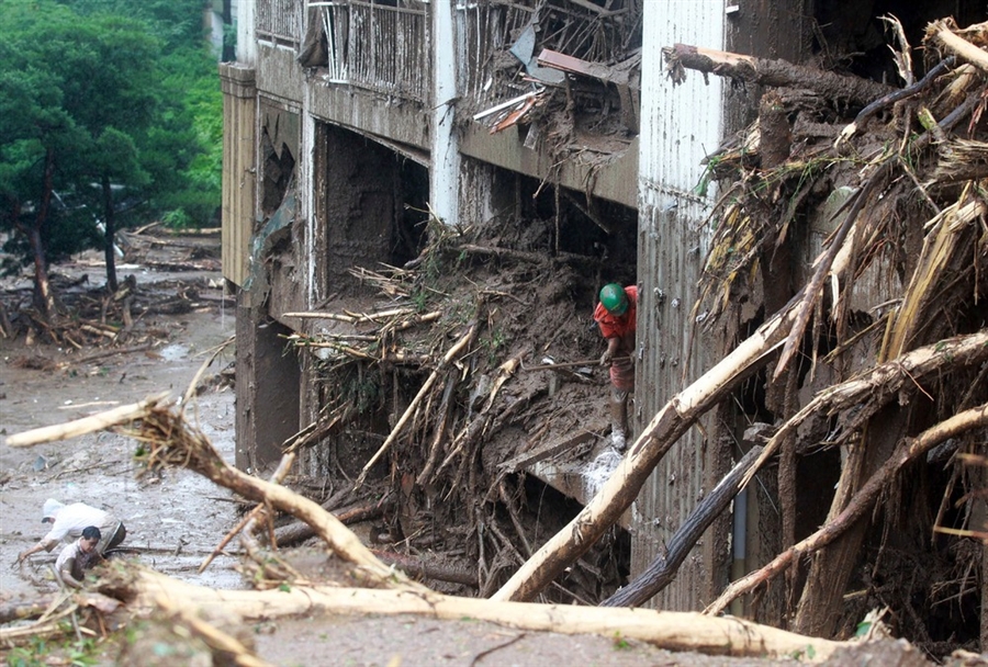
According to Dave Petley, there were two major landslides in the Gang-won Province and Seoul. In the images shown, it looks like a mudslide is also what took place as it was near a lot of vegetation. The debris from that actually penetrated many buildings.


According to BBC News, the Han River experienced major flooding into the city of Seoul due to the rainfall that occurred consecutively for 42 days. "15 people have died and more than 1,500 have been forced from their homes.." Due to the corona-virus, it is extremely difficult to shelter the people affected and the ones who lost their homes. 


Works Cited:

“Mass Wasting.” National Parks Service, U.S. Department of the Interior, 11 Sept. 2019, 

www.nps.gov/subjects/erosion/mass-wasting.htm.

Petley, Dave. “Landslides Mudslides.” The Landslide Blog, American Geophysical Union, 28 July 2011, blogs.agu.org/landslideblog/2011/07/27/devastating-landslides-in-south-korea-and-fears-of-more-to-come/.


Sunday, September 6, 2020

Earthquakes and Seismicity in South Korea


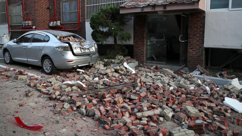
Another South Korea earthquake more cause for alarm about seismic activity  - ABC News

Post #3

Since South Korea is located in the Eurasian Plate, according to geologist Arup Pty, "the seismicity is affected by the complex interaction of the collision of the Indo-Australian and the Eurasian plates and the subduction of the Philippine Sea plates beneath the Eurasian plate along the Japan and the Ryukyu trenches respectively."

South Korea has experienced many earthquakes. The most recent occurred 7 months ago with a magnitude of 3.5. There average magnitudes are in the 3.5-5 range. Four years ago in the Gyeongsangbuk-do area is where four earthquakes occurred. 

Since Japan has high seismicity levels and is only so far away from South Korea, it puts the country at risk. "Off the southeast Korean Peninsula the crust transitions from rifted continental to oceanic crust," says Arup Pty.

Current status of Seismic Hazard Map in KoreaList of earthquakes in South Korea - Wikipedia

2) The History of Earthquakes in Korea - Is Korea free from earthquake  disasters?


Sources:

https://www.jstage.jst.go.jp/article/jgssp/2/20/2_HKG-20/_pdf

“Recent Earthquakes Near South Korea.” Today's Earthquakes in South Korea, 2020, earthquaketrack.com/p/south-korea/recent.

Sunday, August 30, 2020

Plate Tectonic Boundaries of South Korea


Post 2
South Korea is located in the southern portion of the Korean Peninsula and the Eurasian continent and is near the west Pacific mobile belt. According to Natural Hazards: Earth's Processes as Hazards, Disasters, and Catastrophes, Figure 2.4b 
shows that South Korea will be affected by more earthquakes than volcanoes. 
There are a total of three volcanoes in the Korean Peninsula: 
Mt. Baekdu, Mt. Halla, and Ulleung Island. 
Mt. Baekdu is the tallest volcano in the peninsula and last erupted in 1903. Mt. Halla was created over
1.8 million years ago. Finally, Ulleung Island "formed from erupted magma in the East Sea" (Kim, 2019).
According to Dr. Chun-Soo Kim, the Korea-China platform is connected to a shield area, " stable land of 
cratonic nature."
In the images below, it shows that South Korea is a part of the Amurian plate and it is near a divergent 
boundary. 


Sources

Kim, Chun-Soo. Overview of the Tectonic Environment in Korea with Reference to HLW DisposalOct. 1997, inis.iaea.org/collection/NCLCollectionStore/_Public/29/009/29009933.pdf.

Keller, Edward A., et al. Natural Hazards: Earth's Processes as Hazards, Disasters, and Catastrophes. Routledge, Taylor & Francis Group, 2016.

Kim, Jong-Seok. “Volcanic Eruptions in Korea.” Volcano > Current State > Earthquake/Tsunami/Volcano, 2009, www.kma.go.kr/eng/weather/current_state/volcano.jsp#:~:text=There%20are%20three%20volcanoes%20in,The%20second%20volcano%20is%20Mt.






Final Hazards Report

  South Korea's Main Hazards The two main hazards that are most dangerous are Typhoons and Flooding.  Typhoons have affected South Korea...